Historically, to build a house with a simple cellar you would dig out the ground to a depth of around 6ft, the cellar walls would have been constructed with a lining of stone or brick and with a drain for water within the cellar. The floors would have been built up on crushed stone or sand to provide a level surface and paved, usually with flags. Brick paving became more common in later periods.
In small buildings the cellars were simply covered by the timber ground floor and ceilings of lath and plaster, but in larger houses arches and barrel vaults were often used to enable the floor above to be paved. If constructed for storage purposes, domestic cellars often have stone benches for salting meat and coal chutes, which are common across the country.
The building of a cellar may have been as follows. Initially, the void would have been dug out and all the spoil removed by spade, windlass and bucket. Then the initial side walls would have been constructed, probably of local stone. The arches to span the cellar would then have been “sprung” across the width of the cellar using scaffolding or centring of timber underneath to support them. Doorways in 0 he walls provided access to neighbouring cellars during contrstruction.
Striking or removing the centring was a dangerous task and It would have taken months to build each cellar, in part because lime mortar would have been used. Lime mortar sets properly only over time, and that time depends on the precise mix used and the local climatic conditions.
It was at that moment that failures in arch building often occurred, either because the lime mortar was insufficiently set or there were constructions faults.
The roof itself was added following construction of the arches by placing planks longitudinally from arch to arch.
An Archaeological Evaluation at Roussillon Barracks
An Archaeological Evaluation atRoussillon Barracks Chichester, West Sussex
Planning Reference No: CC/10/03490/FUL Phases 1a & 1b Project No: 4861 Site Code: RBC 11ASE Report No: 2011128 OASIS id: archaeol6-102472 By Diccon HartWith contributions by Sarah Porteus Illustrations by Fiona GriffinJune 2011
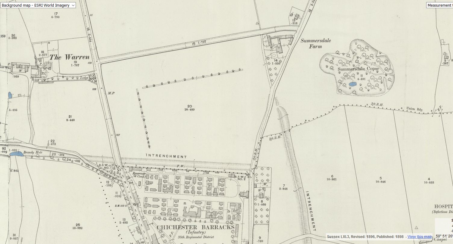
summersdale golf course and mr Stride
Between The Drive’s western and southern ends, Charles Stride built a private estate in c.1905 which included a nine hole golf course designed by James Braid, a lodge (Uplands), and a mansion (Woodland Place) with tree-lined grounds which, as Rew Lane, was developed in the late 1950s. The golf course was too close to the Goodwood course to be a commercial success and it was given up for gravel extraction immediately prior to the first World War, with a mineral branch line connected later to the Chichester-Midhurst railway. His golf course and pavilion is mentioned in https://golfsmissinglinks.co.uk/index.php/england/south-east/sussex/851-sus-summersdale-golf-club-chichester
A number of those readers remembered a story about tunnels underneath Hansford Menswear, also in South Street, so we spoke the shop''s owner to find out more. Matthew Hansford described a blocked-off passage in cellar of the shop, which he believes may have led to the cathedral
First, there are no maps in the presentation to hidden tunnels , all information is in the public domain and if we get distracted during our searches that is only natural. I will try and make this as interesting as possible and we will not be getting our boots dirty.
Why have a cellar? Having a cellar was actually quite an expensive and a time consuming affair. Most people didn't. There was no point unless there was something to store or servants to hide.
AArc141/14/EVAL Roussillon Park, Broyle Road, Chichester, West Sussex, PO19 BBL
Sporadic finds represent the early prehistoric period in the vicinity of the Project Site, with the discovery of Palaeolithic axe in a garden on Brandy Hole Lane (c. 600m to the NW) and a Neolithic stone axe, in the vicinity of Spitalfield Lane, over 1km to the SE (Lee 2008: 9).
Bronze Age activity has been recorded c. 500m to the east of the site, in the vicinity of Garyiingwell Hospital, where evidence for settlement was identified along with remains of six cremation burials (Lee 2008: 9).
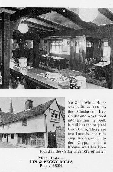
Max T I recall that there is a short length of tunnel (blocked off at both ends) under the old White Horse pub in South St. (now Prezzo restaurant, since 2005). Story in the pub was that it was part of a tunnel running from the Cathedral up to the Guildhall in Priory Park. Although the tunnel is there, I was never sure of its true purpose or the truth of its start / finish. Thought that it was worth mentioning it on here though.
It was under the Crypt and right next to the cathedral
Maureen Williams, 82, of Westgate, recalled a school trip into the rumoured tunnels under Chichester when she was at Chichester High School for Girls.
She estimates she was in her early teens at the time and said she chose to share her memories after reading about the search for evidence in this newspaper.


