Random articles of interest
An Archaeological Evaluation at Roussillon Barracks
An Archaeological Evaluation atRoussillon Barracks Chichester, West Sussex
Planning Reference No: CC/10/03490/FUL Phases 1a & 1b Project No: 4861 Site Code: RBC 11ASE Report No: 2011128 OASIS id: archaeol6-102472 By Diccon HartWith contributions by Sarah Porteus Illustrations by Fiona GriffinJune 2011
Russilon Barracks

The Chichester SMR holds information for 48 sites, whilst the National Monuments Record
Centre holds details of a further 16 sites within the study area. An additional four sites were
located through analysis of historic mapping and during the course of the walkover survey and
one from aerial photographs. Full site descriptions and locations can be seen in Appendix B.
Within the report, the bracketed numbers after site descriptions relate to those allocated to
individual sites in Appendix B and on Figure 2.
Architects concept plan - Graylingwell aerial designers dream
architects concept plan - graylingwell aerial designers dream. This vision is far from reality and some say even mention the trades description act.
Brandy Hole caving session

From trying to locate the areas marked on the old maps as smugglers or roman caves at the approc following locations. Our team tried to take photos as best we could.
su 85228 06608 50.8527, -0.7906
su 85255 06596 50.8526, -0.7902
su 85249 06577 50.8524, -0.7903
su 85248 06565 50.8523, -0.7903
su 85329 06661 50.8532, -0.7892
su 85359 06657 50.8531, -0.7887


Graylingwell plan with well and springs ponds
Graylingwell plan with well and springs ponds.
whyke lodge
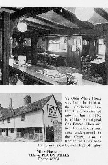
White Horse / Prezzo
Max T
I recall that there is a short length of tunnel (blocked off at both ends) under the old White Horse pub in South St. (now Prezzo restaurant, since 2005). Story in the pub was that it was part of a tunnel running from the Cathedral up to the Guildhall in Priory Park. Although the tunnel is there, I was never sure of its true purpose or the truth of its start / finish. Thought that it was worth mentioning it on here though.
st johns church
About 50 years ago in the vestry of St. John’s Church In Chichester a flag stone was taken up by some teenagers and a tunnel was revealed. Apparently it runs along under St Johns Street in a south / north direction
.MS
Chichester Culverts
We do not suggest going into the culverts.
These are not classified as tunnels and can be dangerous
video of culverts/storm drains/winterbourne route
Map of Chichester showing Rivers
www.streetmap.co.uk\\/map.srf?x=486359&y=104953&z=120&sv=chichester&st=3&tl=Map%20of%20Chichester%2C%20West%20Sussex%20[City%2FLarge%20Town]&searchp=ids.srf&mapp=map.srf&fbclid=IwAR2IV7YUeQ8u_GBTHRE24fSpUvVRwu5CpZxdPt1fs_injtw73WMxXbTQ25s

First, there are no maps in the presentation to hidden tunnels , all information is in the public do...

Are you curious about the tunnels in Chichester? If you are, you are not alone. Many people have won...

Borehole drilling is a technique that allows you to access underground water sources by creating a d...

AArc141/14/EVAL Roussillon Park, Broyle Road, Chichester, West Sussex, PO19 BBL
Sporadic finds repr...

A number of those readers remembered a story about tunnels underneath Hansford Menswear, also in Sou...

Maureen Williams, 82, of Westgate, recalled a school trip into the rumoured tunnels under Chichester...

An introduction to researching properties
{youtube}R3F2rWapKzw{/youtube}


architects concept plan - graylingwell aerial designers dream. This vision is far from reality and s...

Maureen Williams, 82, of Westgate, recalled a school trip into the rumoured tunnels under Chichester...
More In Articles


