To the west of the Lavant Road, Warren Farm consisted of 67 acres bounded to the north by Lavant Common, and to the south by Brandy Hole Lane. The Ecclesiastical Commissioners, having taken the land over in January 1870, sold it freehold a few months later to Robert Dendy, a local banker, for £1,137.7s. He revitalised the farm and completed a period of re- building by the early 1880s when the farm had to support six families.
The farm changed hands twice through widow Matilda Bagot in 1882 and Charles Ormerod, who inherited when Matilda died in 1889, before Henry Halsted bought it in 1894. Halsted was the owner of a local ironmongers, and iron and brass foundry in South Pallant. He died in 1911 followed by his wife Margaret in 1919.
The farm was auctioned in October 1919 but remained unsold. The 1920s was still not a good time for farming, but Chichester was expanding and there was demand for good quality housing. The property was divided into individual but generous building plots along the Lavant Road, Brandy Hole Lane, Warren Farm Lane, and what became known as Hunters Way. The Warren, its drive, buildings, grounds and Warren Lodge were excluded, as were fields on either side of the Chichester-Midhurst railway. The building plots, all with the same Restrictive Covenants, were sold off in the 1920s and 30s. (Stride’s plots on the other side of the Lavant Road, with similar covenants, were sold a few years earlier).
***
In the 1860s, the Chichester to Midhurst railway was planned to cross under Brandy Hole Lane and bisect Warren Farm on its way to Lavant, Midhurst and Haslemere. It was to be a ‘contractors’ line, built by a group of speculators for sale to an established railway company. The first sod was turned by Lord Henry Lennox (MP for Chichester) in April 1865, but the Haslemere section was officially abandoned in 1868. Financial and legal wrangles continued to create severe delays and a second Parliamentary Bill
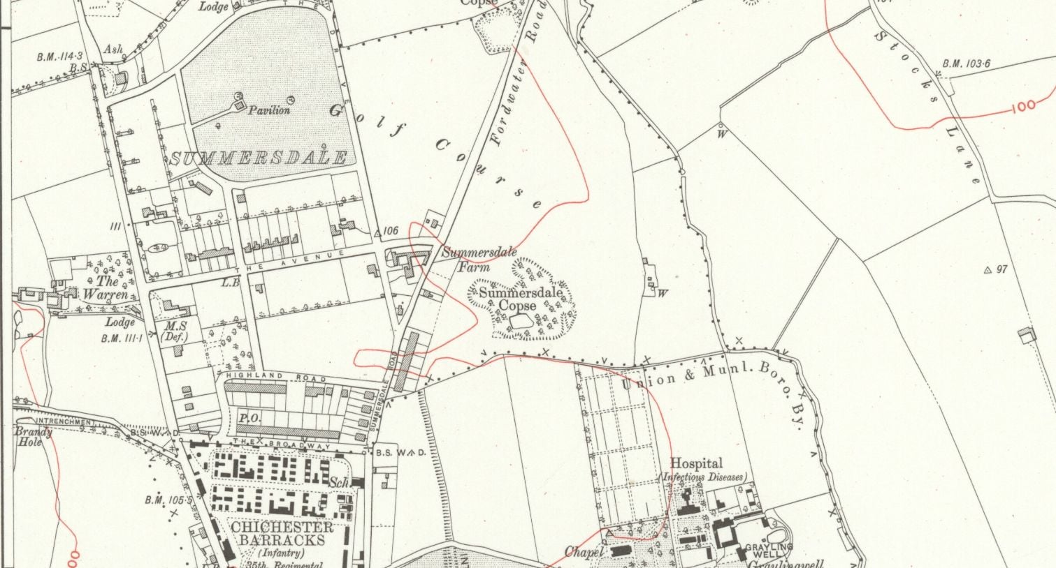
summeerdale football ,I have an update on the old newspaper article relating to Summersdale and the tunnel found under a football pitch. I sent an email to the Summersdale Residents Association, and they were extremely helpful with one of the members being able to identify a location for the site of the pitch. Looking at some old maps and combining the documents from Liam Mandville regarding subsidence etc. the area between The Avenue and Highland Road (on the Eastern side), does fit well as to the location. Many of the properties built on this site have substantial gardens so there may still be something to find that could explain what was found by the groundkeeper all those years ago? ,5f6f8e5fb6881-116345275_10157348686446892_326855352233187857_n.jpg,5f6f8e5fb7b45-116168775_10157348685396892_1033817068655264665_n.jpg
Borehole drilling is a technique that allows you to access underground water sources by creating a deep and narrow hole in the ground. In this blog post, we will explain what borehole drilling is, how it works, and what are its benefits and challenges.
It was under the Crypt and right next to the cathedral
Maureen Williams, 82, of Westgate, recalled a school trip into the rumoured tunnels under Chichester when she was at Chichester High School for Girls.
She estimates she was in her early teens at the time and said she chose to share her memories after reading about the search for evidence in this newspaper.
From trying to locate the areas marked on the old maps as smugglers or roman caves at the approc following locations. Our team tried to take photos as best we could.
su 85228 06608 50.8527, -0.7906 su 85255 06596 50.8526, -0.7902 su 85249 06577 50.8524, -0.7903 su 85248 06565 50.8523, -0.7903 su 85329 06661 50.8532, -0.7892 su 85359 06657 50.8531, -0.7887
AArc141/14/EVAL Roussillon Park, Broyle Road, Chichester, West Sussex, PO19 BBL
Sporadic finds represent the early prehistoric period in the vicinity of the Project Site, with the discovery of Palaeolithic axe in a garden on Brandy Hole Lane (c. 600m to the NW) and a Neolithic stone axe, in the vicinity of Spitalfield Lane, over 1km to the SE (Lee 2008: 9).
Bronze Age activity has been recorded c. 500m to the east of the site, in the vicinity of Garyiingwell Hospital, where evidence for settlement was identified along with remains of six cremation burials (Lee 2008: 9).
The Graylingwell Heritage Project has been a community based heritage and arts programme located in Chichester, West Sussex.
The original Victorian buildings had a central boiler house with the water tower which is, after the Cathedral spire, by far the tallest building in Chichester. And if you go up to the Trundle and look down on Chichester, the only two buildings you can see are the Cathedral spire and the Graylingwell water tower.
A singular happening lay behind the prosaic news on saturday that the chuichester and District League football fixture, Summersadale VS Boxgrove, had o be postponed owing to the ground on this hill suburb of Chichester being unfit.
DD I worked at 65 East Street when it was ''Hammick''s Bookshop'' (now Specsavers). We had a trapdoor in the middle of the floor that led down to a tunnel-shaped cellar that seemed to extend through the front of the shop and under the pavement outside. I didn''t see any evidence of it ever having joined another tunnel and imagine that perhaps there was once an opening in the pavement for deliveries.


