There is rumoured to be a tunnel from the white horse to the buttery and then from the buttery to the cathedral.
Regarding a tunnel from the crypt to the cathedral. Apparently Keats while upstairs being "entertained" watched the monks lock the gate to the cathedral. Now did he have xray specs on ??? That''s the pic of the guy gesturing towards the shelves is where the door way used to be

AArc141/14/EVAL Roussillon Park, Broyle Road, Chichester, West Sussex, PO19 BBL
Sporadic finds represent the early prehistoric period in the vicinity of the Project Site, with
the discovery of Palaeolithic axe in a garden on Brandy Hole Lane (c. 600m to the NW)
and a Neolithic stone axe, in the vicinity of Spitalfield Lane, over 1km to the SE (Lee 2008:
9).
Bronze Age activity has been recorded c. 500m to the east of the site, in the vicinity of
Garyiingwell Hospital, where evidence for settlement was identified along with remains of
six cremation burials (Lee 2008: 9).
Read more: ABSOLUTE ARCHAEOLOGY Rousillonn Barracks Evaluation

Maureen Williams, 82, of Westgate, recalled a school trip into the rumoured tunnels under Chichester when she was at Chichester High School for Girls.
She estimates she was in her early teens at the time and said she chose to share her memories after reading about the search for evidence in this newspaper.
Read more: It was under the Crypt and right next to the cathedral
About 50 years ago in the vestry of St. John’s Church In Chichester a flag stone was taken up by some teenagers and a tunnel was revealed. Apparently it runs along under St Johns Street in a south / north direction
.MS
EAST STREET No 40
SU 8604 NW 4/103
Grade II
C18. 3 storeys and attic. 2 windows. Red brick.
Panelled parapet hiding
dormers. Sash windows in reveals in flat arches; rubbed brick voussoirs; glazing bars missing in lower windows.
C20 plate glass shop front and fascia on ground floor.
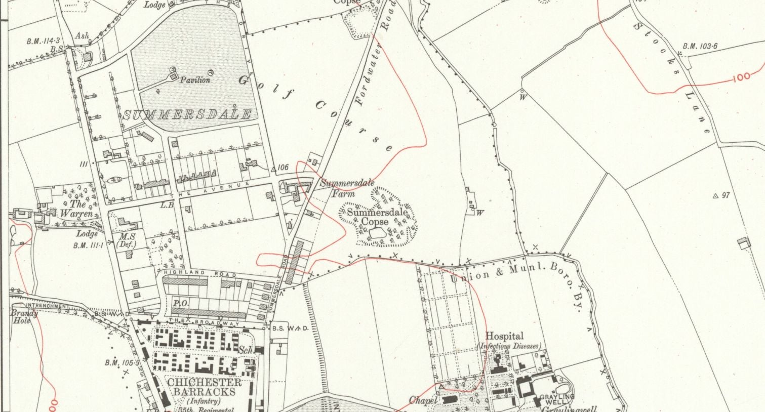
summeerdale football ,I have an update on the old newspaper article relating to Summersdale and the tunnel found under a football pitch. I sent an email to the Summersdale Residents Association, and they were extremely helpful with one of the members being able to identify a location for the site of the pitch. Looking at some old maps and combining the documents from Liam Mandville
regarding subsidence etc. the area between The Avenue and Highland Road (on the Eastern side), does fit well as to the location. Many of the properties built on this site have substantial gardens so there may still be something to find that could explain what was found by the groundkeeper all those years ago? ,5f6f8e5fb6881-116345275_10157348686446892_326855352233187857_n.jpg,5f6f8e5fb7b45-116168775_10157348685396892_1033817068655264665_n.jpg
architects concept plan - graylingwell aerial designers dream. This vision is far from reality and some say even mention the trades description act.
Read more: Architects concept plan - Graylingwell aerial designers dream
Graylingwell plan with well and springs ponds.

The Chichester SMR holds information for 48 sites, whilst the National Monuments Record
Centre holds details of a further 16 sites within the study area. An additional four sites were
located through analysis of historic mapping and during the course of the walkover survey and
one from aerial photographs. Full site descriptions and locations can be seen in Appendix B.
Within the report, the bracketed numbers after site descriptions relate to those allocated to
individual sites in Appendix B and on Figure 2.


