

Powered by Phoca Gallery
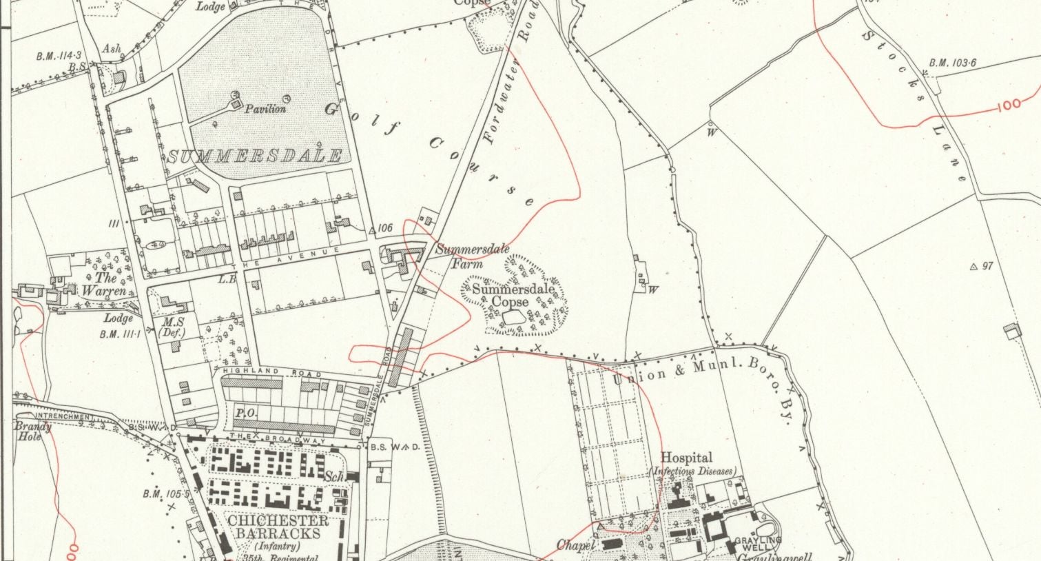
summeerdale football ,I have an update on the old newspaper article relating to Summersdale and the tunnel found under a football pitch. I sent an email to the Summersdale Residents Association, and they were extremely helpful with one of the members being able to identify a location for the site of the pitch. Looking at some old maps and combining the documents from Liam Mandville
regarding subsidence etc. the area between The Avenue and Highland Road (on the Eastern side), does fit well as to the location. Many of the properties built on this site have substantial gardens so there may still be something to find that could explain what was found by the groundkeeper all those years ago? ,5f6f8e5fb6881-116345275_10157348686446892_326855352233187857_n.jpg,5f6f8e5fb7b45-116168775_10157348685396892_1033817068655264665_n.jpg
'
Summersdale is an attractive area in the north of Chichester. Spacious
and leafy, the character of the area is now under threat with many houses
on large plots at risk of demolition and re-development. It is an historic
suburb with high quality architecture in street scenes that are worthy of
enlightened protection.
FOOTBALL FIELD SURPRISE.
A singular happening lay behind the prosaic news on saturday that the
chuichester and District League football fixture, Summersadale VS Boxgrove, had o be postponed
owing to the ground on this hill suburb of Chichester being unfit.

The Chichester SMR holds information for 48 sites, whilst the National Monuments Record
Centre holds details of a further 16 sites within the study area. An additional four sites were
located through analysis of historic mapping and during the course of the walkover survey and
one from aerial photographs. Full site descriptions and locations can be seen in Appendix B.
Within the report, the bracketed numbers after site descriptions relate to those allocated to
individual sites in Appendix B and on Figure 2.
DD
I worked at 65 East Street when it was ''Hammick''s Bookshop'' (now Specsavers). We had a trapdoor in the middle of the floor that led down to a tunnel-shaped cellar that seemed to extend through the front of the shop and under the pavement outside. I didn''t see any evidence of it ever having joined another tunnel and imagine that perhaps there was once an opening in the pavement for deliveries.
EAST STREET No 40
SU 8604 NW 4/103
Grade II
C18. 3 storeys and attic. 2 windows. Red brick.
Panelled parapet hiding
dormers. Sash windows in reveals in flat arches; rubbed brick voussoirs; glazing bars missing in lower windows.
C20 plate glass shop front and fascia on ground floor.
Max T
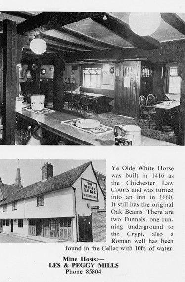
I recall that there is a short length of tunnel (blocked off at both ends) under the old White Horse pub in South St. (now Prezzo restaurant, since 2005). Story in the pub was that it was part of a tunnel running from the Cathedral up to the Guildhall in Priory Park. Although the tunnel is there, I was never sure of its true purpose or the truth of its start / finish. Thought that it was worth mentioning it on here though.

From trying to locate the areas marked on the old maps as smugglers or roman caves at the approc following locations. Our team tried to take photos as best we could.
su 85228 06608 50.8527, -0.7906
su 85255 06596 50.8526, -0.7902
su 85249 06577 50.8524, -0.7903
su 85248 06565 50.8523, -0.7903
su 85329 06661 50.8532, -0.7892
su 85359 06657 50.8531, -0.7887

AArc141/14/EVAL Roussillon Park, Broyle Road, Chichester, West Sussex, PO19 BBL
Sporadic finds represent the early prehistoric period in the vicinity of the Project Site, with
the discovery of Palaeolithic axe in a garden on Brandy Hole Lane (c. 600m to the NW)
and a Neolithic stone axe, in the vicinity of Spitalfield Lane, over 1km to the SE (Lee 2008:
9).
Bronze Age activity has been recorded c. 500m to the east of the site, in the vicinity of
Garyiingwell Hospital, where evidence for settlement was identified along with remains of
six cremation burials (Lee 2008: 9).


