Graylingwell plan with well and springs ponds.
Graylingwell plan with well and springs ponds
- Details
- Hits: 684
Graylingwell plan with well and springs ponds.
FOOTBALL FIELD SURPRISE.
A singular happening lay behind the prosaic news on saturday that the
chuichester and District League football fixture, Summersadale VS Boxgrove, had o be postponed
owing to the ground on this hill suburb of Chichester being unfit.
MB
My mum worked 27 east street and when it flooded in the 90s they found a big cellar and you could look down into an area which was like a tunnel
'
Summersdale is an attractive area in the north of Chichester. Spacious
and leafy, the character of the area is now under threat with many houses
on large plots at risk of demolition and re-development. It is an historic
suburb with high quality architecture in street scenes that are worthy of
enlightened protection.
An introduction to researching properties
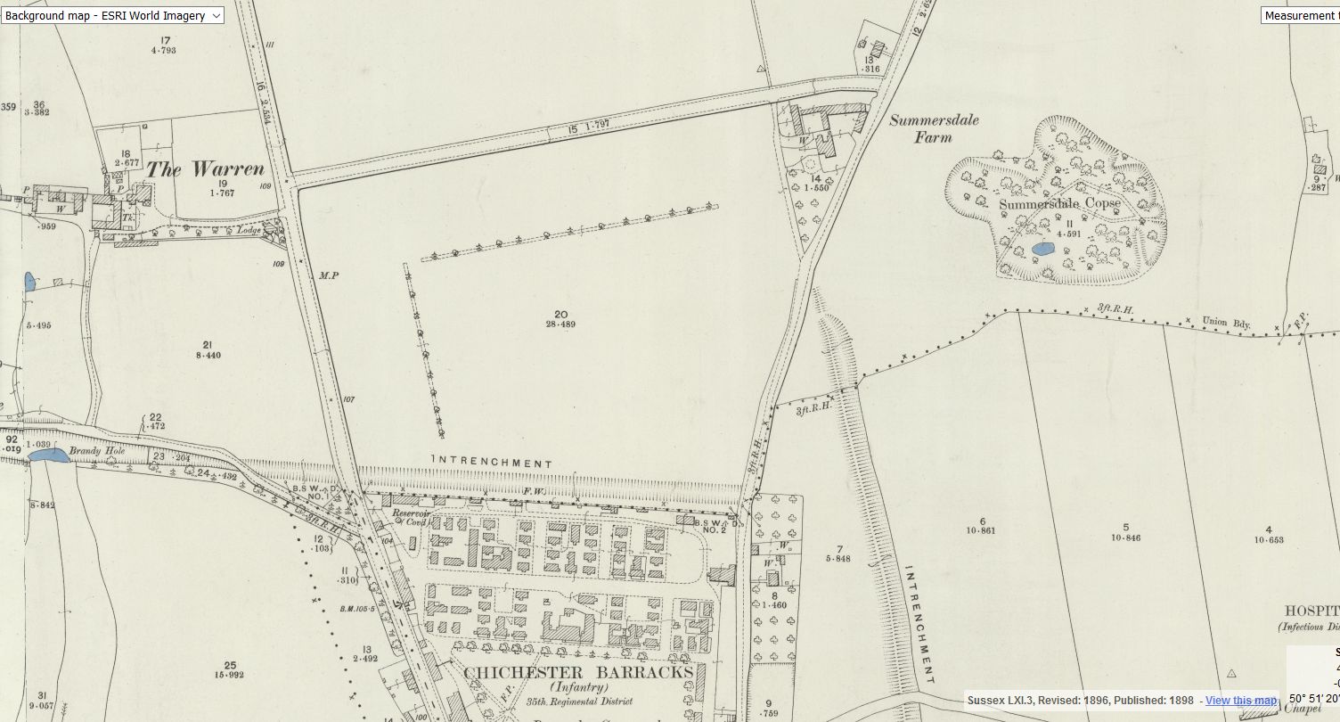
Between The Drive’s western and southern ends, Charles Stride built a private estate in c.1905 which included a nine hole golf course designed by James Braid, a lodge (Uplands), and a mansion (Woodland Place) with tree-lined grounds which, as Rew Lane, was developed in the late 1950s. The golf course was too close to the Goodwood course to be a commercial success and it was given up for gravel extraction immediately prior to the first World War, with a mineral branch line connected later to the Chichester-Midhurst railway.
His golf course and pavilion is mentioned in https://golfsmissinglinks.co.uk/index.php/england/south-east/sussex/851-sus-summersdale-golf-club-chichester
The club was founded in 1904.
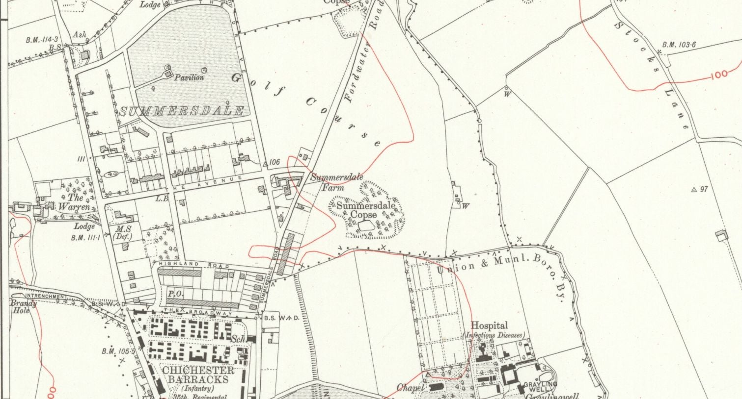
summeerdale football ,I have an update on the old newspaper article relating to Summersdale and the tunnel found under a football pitch. I sent an email to the Summersdale Residents Association, and they were extremely helpful with one of the members being able to identify a location for the site of the pitch. Looking at some old maps and combining the documents from Liam Mandville
regarding subsidence etc. the area between The Avenue and Highland Road (on the Eastern side), does fit well as to the location. Many of the properties built on this site have substantial gardens so there may still be something to find that could explain what was found by the groundkeeper all those years ago? ,5f6f8e5fb6881-116345275_10157348686446892_326855352233187857_n.jpg,5f6f8e5fb7b45-116168775_10157348685396892_1033817068655264665_n.jpg
About 50 years ago in the vestry of St. John’s Church In Chichester a flag stone was taken up by some teenagers and a tunnel was revealed. Apparently it runs along under St Johns Street in a south / north direction
.MS
An Archaeological Evaluation atRoussillon Barracks Chichester, West Sussex
Planning Reference No: CC/10/03490/FUL Phases 1a & 1b Project No: 4861 Site Code: RBC 11ASE Report No: 2011128 OASIS id: archaeol6-102472 By Diccon HartWith contributions by Sarah Porteus Illustrations by Fiona GriffinJune 2011


