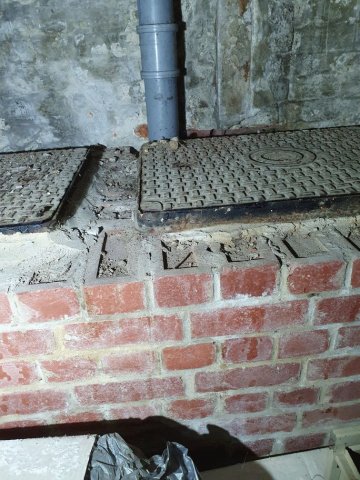
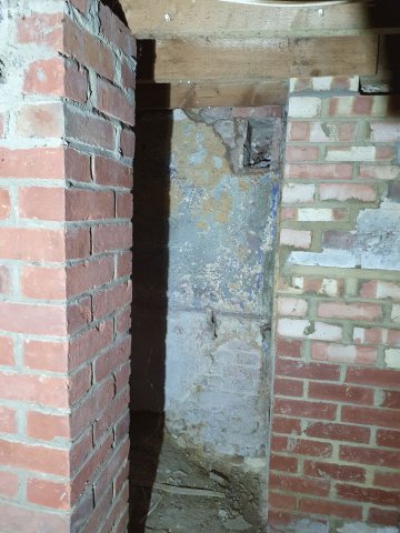
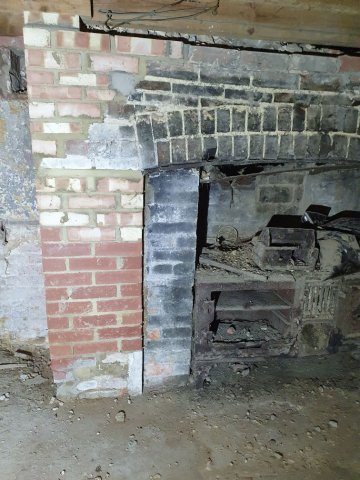
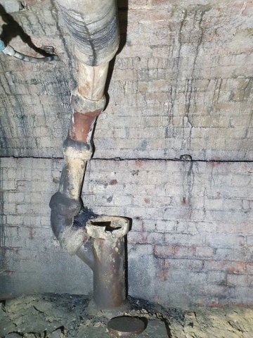
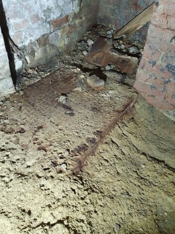
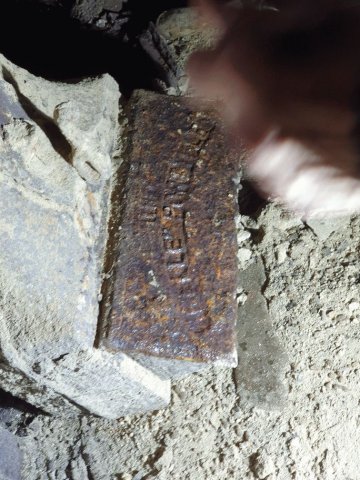
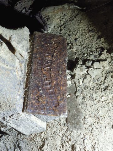
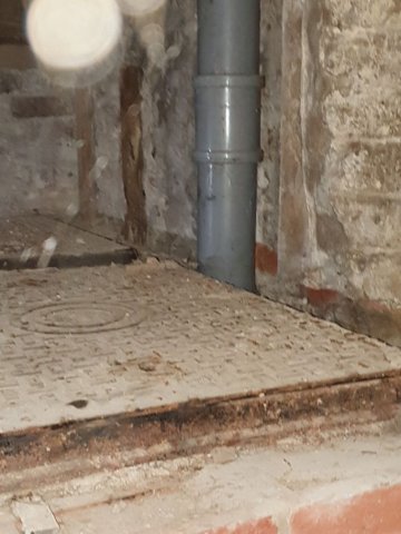
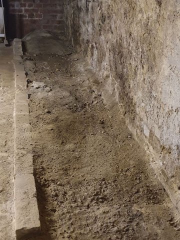
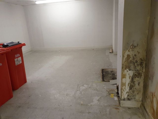
basement and general shots of 40 east street chichester
Powered by Phoca Gallery
basement and general shots of 40 east street chichester

Are you curious about the tunnels in Chichester? If you are, you are not alone. Many people have wondered about the existence and purpose of these underground passages that are said to run under the city. Some claim they have seen them, others have heard stories about them, but what is the truth behind the mystery?
In this blog post, I will try to shed some light on the tunnels in Chichester, based on some web searches and historical sources. I will also share some of the rumours and legends that surround them, and invite you to share your own experiences or opinions in the comments section.
What are the tunnels in Chichester?
One of the most common questions I’m asked about Peterborough’s history is whether there are any tunnels under the city. Local legends say that there is a tunnel stretching from the Cathedral to Monk’s Cave at Longthorpe. Similar tunnels are alleged to stretch from the Cathedral to the abbeys at Thorney or Crowland.
These are familiar myths in many historic cities across the UK, mostly urban legends based on half remembrances of sewers, cellars or crawlspaces, coupled with wishful thinking and rumour.
The stories of tunnels from Peterborough to
MB
My mum worked 27 east street and when it flooded in the 90s they found a big cellar and you could look down into an area which was like a tunnel
video of culverts/storm drains/winterbourne route
Map of Chichester showing Rivers
www.streetmap.co.uk\\/map.srf?x=486359&y=104953&z=120&sv=chichester&st=3&tl=Map%20of%20Chichester%2C%20West%20Sussex%20[City%2FLarge%20Town]&searchp=ids.srf&mapp=map.srf&fbclid=IwAR2IV7YUeQ8u_GBTHRE24fSpUvVRwu5CpZxdPt1fs_injtw73WMxXbTQ25s
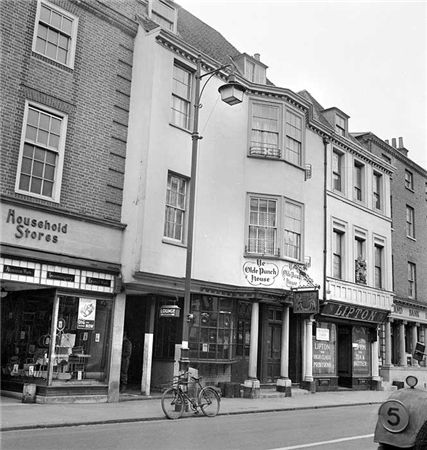
ON THE south side of East Street, close to the Market Cross, lies number 92 which up until fairly recently was The Royal Arms public house (also known as Ye Olde Punch House).
Although the façade dates to the Georgian era, the building is of a timber-framed construction said to date from the 16th century.
Much of the original building survives including highly decorated plaster ceilings displaying the Tudor Rose and fleur-de-lis.
It was once a private town house belonging to the Lumley family of Stansted.

Brandy Hole Lane, East Broyle Copse area in the northwest part of Chichester. A well-developed doline line extends east-west across the area to the north of Brandy Hole Lane, along the underlying Chalk-Reading Beds boundary.
The Environment Agency has made 1m-resolution LIDAR imagery coverage for large areas of England and Wales freely available on the internet under Open Government Licence (www.lidarfinder.com).

First, there are no maps in the presentation to hidden tunnels , all information is in the public domain and if we get distracted during our searches that is only natural.
I will try and make this as interesting as possible and we will not be getting our boots dirty.
Why have a cellar?
Having a cellar was actually quite an expensive and a time consuming affair. Most people didn't. There was no point unless there was something to store or servants to hide.
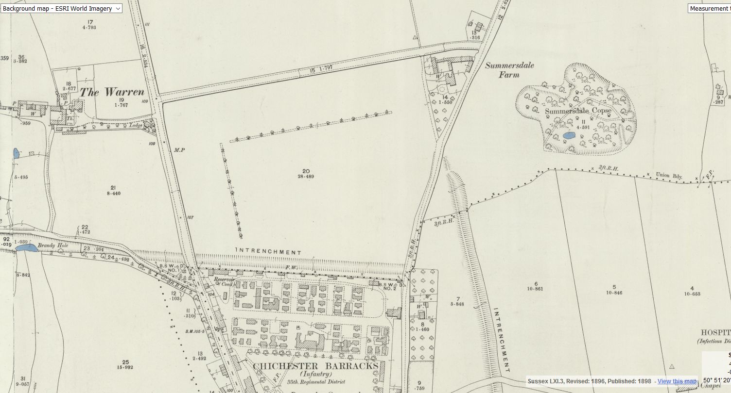
Between The Drive’s western and southern ends, Charles Stride built a private estate in c.1905 which included a nine hole golf course designed by James Braid, a lodge (Uplands), and a mansion (Woodland Place) with tree-lined grounds which, as Rew Lane, was developed in the late 1950s. The golf course was too close to the Goodwood course to be a commercial success and it was given up for gravel extraction immediately prior to the first World War, with a mineral branch line connected later to the Chichester-Midhurst railway.
His golf course and pavilion is mentioned in https://golfsmissinglinks.co.uk/index.php/england/south-east/sussex/851-sus-summersdale-golf-club-chichester
The club was founded in 1904.


