architects concept plan - graylingwell aerial designers dream. This vision is far from reality and some say even mention the trades description act.
architects concept plan - graylingwell aerial designers dream. This vision is far from reality and some say even mention the trades description act.
DD
I worked at 65 East Street when it was ''Hammick''s Bookshop'' (now Specsavers). We had a trapdoor in the middle of the floor that led down to a tunnel-shaped cellar that seemed to extend through the front of the shop and under the pavement outside. I didn''t see any evidence of it ever having joined another tunnel and imagine that perhaps there was once an opening in the pavement for deliveries.
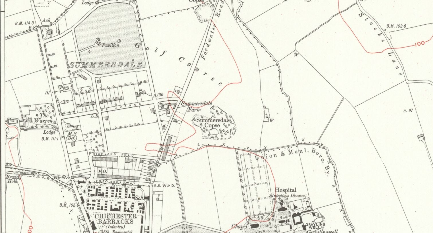
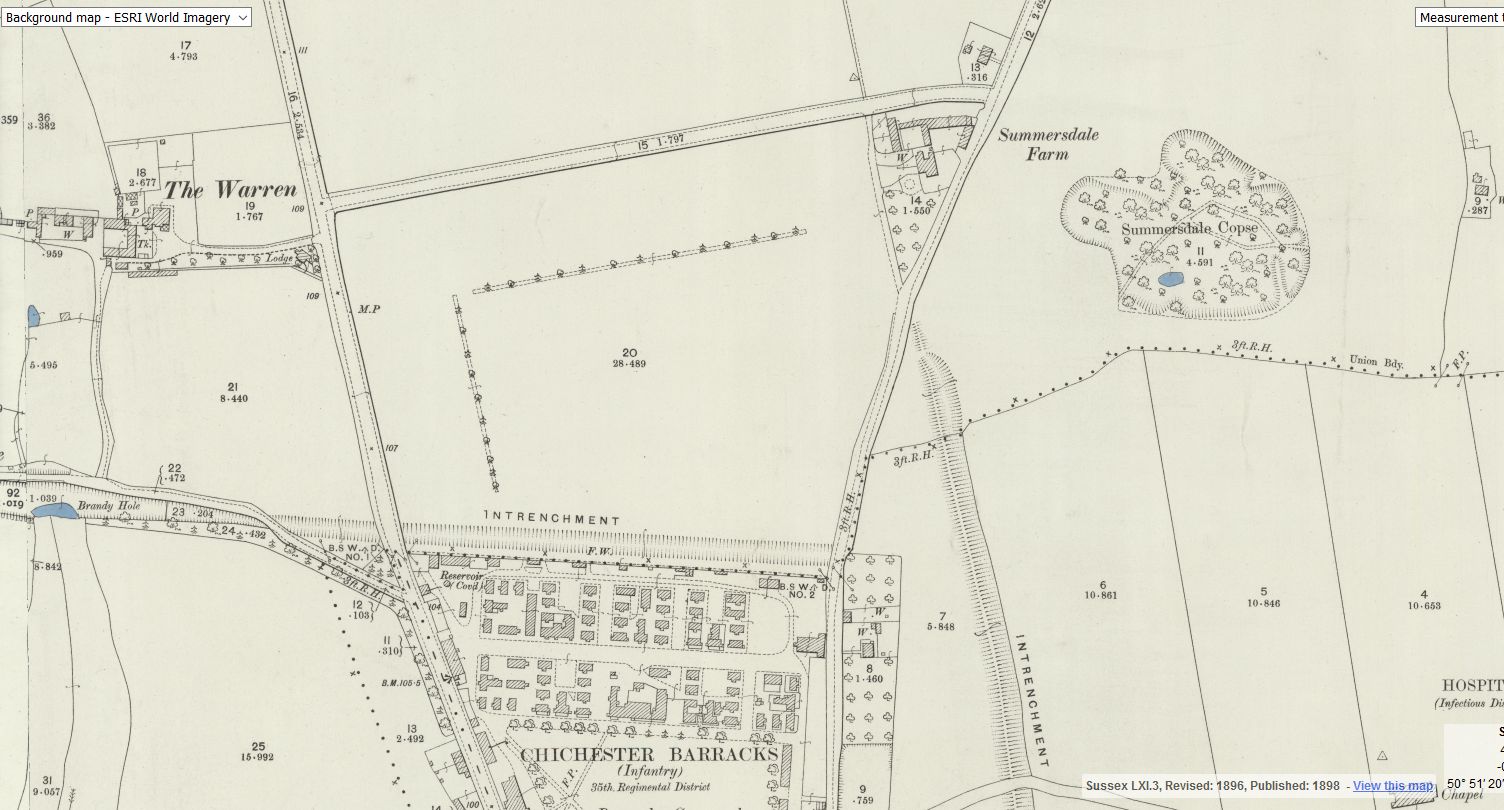
summeerdale football ,I have an update on the old newspaper article relating to Summersdale and the tunnel found under a football pitch. I sent an email to the Summersdale Residents Association, and they were extremely helpful with one of the members being able to identify a location for the site of the pitch. Looking at some old maps and combining the documents from Liam Mandville
regarding subsidence etc. the area between The Avenue and Highland Road (on the Eastern side), does fit well as to the location. Many of the properties built on this site have substantial gardens so there may still be something to find that could explain what was found by the groundkeeper all those years ago? ,5f6f8e5fb6881-116345275_10157348686446892_326855352233187857_n.jpg,5f6f8e5fb7b45-116168775_10157348685396892_1033817068655264665_n.jpg
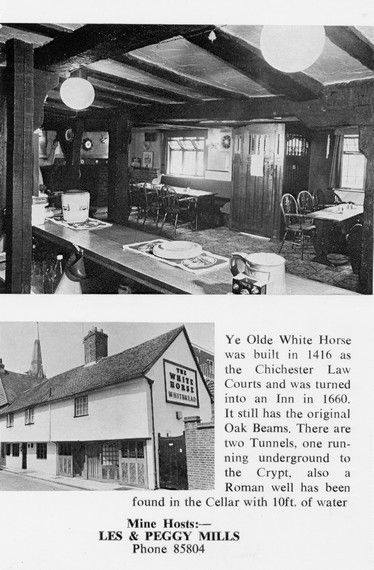
There is rumoured to be a tunnel from the white horse to the buttery and then from the buttery to the cathedral.
Regarding a tunnel from the crypt to the cathedral. Apparently Keats while upstairs being "entertained" watched the monks lock the gate to the cathedral. Now did he have xray specs on ??? That''s the pic of the guy gesturing towards the shelves is where the door way used to be
Max T
I recall that there is a short length of tunnel (blocked off at both ends) under the old White Horse pub in South St. (now Prezzo restaurant, since 2005). Story in the pub was that it was part of a tunnel running from the Cathedral up to the Guildhall in Priory Park. Although the tunnel is there, I was never sure of its true purpose or the truth of its start / finish. Thought that it was worth mentioning it on here though.

AArc141/14/EVAL Roussillon Park, Broyle Road, Chichester, West Sussex, PO19 BBL
Sporadic finds represent the early prehistoric period in the vicinity of the Project Site, with
the discovery of Palaeolithic axe in a garden on Brandy Hole Lane (c. 600m to the NW)
and a Neolithic stone axe, in the vicinity of Spitalfield Lane, over 1km to the SE (Lee 2008:
9).
Bronze Age activity has been recorded c. 500m to the east of the site, in the vicinity of
Garyiingwell Hospital, where evidence for settlement was identified along with remains of
six cremation burials (Lee 2008: 9).
Read more: ABSOLUTE ARCHAEOLOGY Rousillonn Barracks Evaluation
Between The Drive’s western and southern ends, Charles Stride built a private estate in c.1905 which included a nine hole golf course designed by James Braid, a lodge (Uplands), and a mansion (Woodland Place) with tree-lined grounds which, as Rew Lane, was developed in the late 1950s. The golf course was too close to the Goodwood course to be a commercial success and it was given up for gravel extraction immediately prior to the first World War, with a mineral branch line connected later to the Chichester-Midhurst railway.
His golf course and pavilion is mentioned in https://golfsmissinglinks.co.uk/index.php/england/south-east/sussex/851-sus-summersdale-golf-club-chichester
The club was founded in 1904.

Are you curious about the tunnels in Chichester? If you are, you are not alone. Many people have wondered about the existence and purpose of these underground passages that are said to run under the city. Some claim they have seen them, others have heard stories about them, but what is the truth behind the mystery?
In this blog post, I will try to shed some light on the tunnels in Chichester, based on some web searches and historical sources. I will also share some of the rumours and legends that surround them, and invite you to share your own experiences or opinions in the comments section.
What are the tunnels in Chichester?
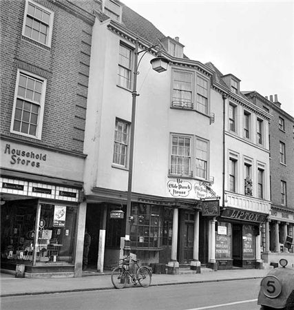
ON THE south side of East Street, close to the Market Cross, lies number 92 which up until fairly recently was The Royal Arms public house (also known as Ye Olde Punch House).
Although the façade dates to the Georgian era, the building is of a timber-framed construction said to date from the 16th century.
Much of the original building survives including highly decorated plaster ceilings displaying the Tudor Rose and fleur-de-lis.
It was once a private town house belonging to the Lumley family of Stansted.
One of the most common questions I’m asked about Peterborough’s history is whether there are any tunnels under the city. Local legends say that there is a tunnel stretching from the Cathedral to Monk’s Cave at Longthorpe. Similar tunnels are alleged to stretch from the Cathedral to the abbeys at Thorney or Crowland.
These are familiar myths in many historic cities across the UK, mostly urban legends based on half remembrances of sewers, cellars or crawlspaces, coupled with wishful thinking and rumour.
The stories of tunnels from Peterborough to


