It is not certain why doline lines have formed along the Chalk – Reading Formation boundary. A possible reason is that the movement of groundwater passing southwards from the chalk has been impeded by clay at the base of the Reading Formation. This bed of clay possibly forms a slight scarp buried beneath the overlying superficial deposits (Cordiner 2019, Fig. 1), which allows groundwater to infiltrate the underlying chalk along pre-existing fractures. Over time downward movement of groundwater has been concentrated at specific sites where chalk fractures have been preferentially enlarged. With enlargement of the fractures in the underlying chalk, superficial deposits have been washed down into them, leaving a crater in the land surface.
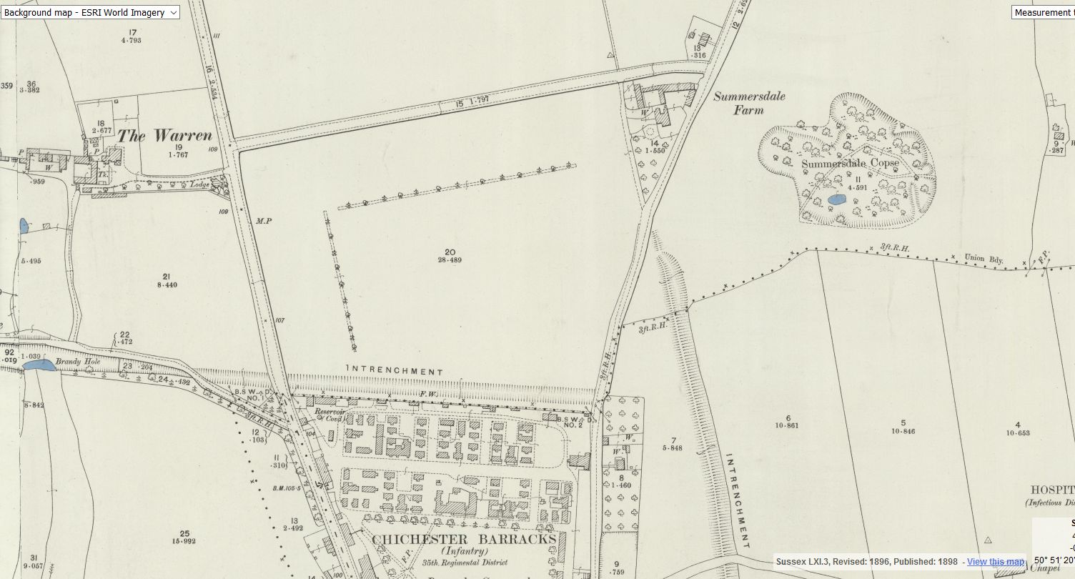
It is known that smugglers in the 18th century used these caves to hide brandy, a barrel of this spirit being discovered when building the foundations for the Chichester-Midhurst line, near where it crossed Brandy Hole Lane. It is known that gravel was formerly dug in this area; the pond in East Broyle Wood Nature Reserve being located in an old quarry. These workings may even go back to Roman times, as indicated on the 1898 O.S. map, as the nearby ‘Intrenchment‘ bank would have been a ready source of flint gravel. It is possible that the Chichester Brandy Holes and caves started out as sink holes, which were later further excavated for flint gravel, and later further excavated by smugglers.
DD I worked at 65 East Street when it was ''Hammick''s Bookshop'' (now Specsavers). We had a trapdoor in the middle of the floor that led down to a tunnel-shaped cellar that seemed to extend through the front of the shop and under the pavement outside. I didn''t see any evidence of it ever having joined another tunnel and imagine that perhaps there was once an opening in the pavement for deliveries.
Between The Drive’s western and southern ends, Charles Stride built a private estate in c.1905 which included a nine hole golf course designed by James Braid, a lodge (Uplands), and a mansion (Woodland Place) with tree-lined grounds which, as Rew Lane, was developed in the late 1950s. The golf course was too close to the Goodwood course to be a commercial success and it was given up for gravel extraction immediately prior to the first World War, with a mineral branch line connected later to the Chichester-Midhurst railway. His golf course and pavilion is mentioned in https://golfsmissinglinks.co.uk/index.php/england/south-east/sussex/851-sus-summersdale-golf-club-chichester
From trying to locate the areas marked on the old maps as smugglers or roman caves at the approc following locations. Our team tried to take photos as best we could.
su 85228 06608 50.8527, -0.7906 su 85255 06596 50.8526, -0.7902 su 85249 06577 50.8524, -0.7903 su 85248 06565 50.8523, -0.7903 su 85329 06661 50.8532, -0.7892 su 85359 06657 50.8531, -0.7887
A number of those readers remembered a story about tunnels underneath Hansford Menswear, also in South Street, so we spoke the shop''s owner to find out more. Matthew Hansford described a blocked-off passage in cellar of the shop, which he believes may have led to the cathedral
About 50 years ago in the vestry of St. John’s Church In Chichester a flag stone was taken up by some teenagers and a tunnel was revealed. Apparently it runs along under St Johns Street in a south / north direction
Borehole drilling is a technique that allows you to access underground water sources by creating a deep and narrow hole in the ground. In this blog post, we will explain what borehole drilling is, how it works, and what are its benefits and challenges.


