The Graylingwell Heritage Project has been a community based heritage and arts programme located in Chichester, West Sussex.
The original Victorian buildings had a central boiler house with the water tower which is, after the Cathedral spire, by far the tallest building in Chichester. And if you go up to the Trundle and look down on Chichester, the only two buildings you can see are the Cathedral spire and the Graylingwell water tower.
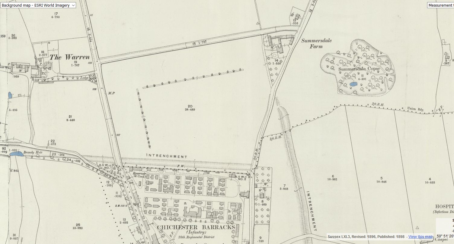
Summersdale is an attractive area in the north of Chichester. Spacious and leafy, the character of the area is now under threat with many houses on large plots at risk of demolition and re-development. It is an historic suburb with high quality architecture in street scenes that are worthy of enlightened protection.
A number of those readers remembered a story about tunnels underneath Hansford Menswear, also in South Street, so we spoke the shop's owner to find out more Matthew Hansford described a blocked-off passage in cellar of the shop, which he believes may have led to the cathedral
It was under the Crypt and right next to the cathedral
Maureen Williams, 82, of Westgate, recalled a school trip into the rumoured tunnels under Chichester when she was at Chichester High School for Girls.
She estimates she was in her early teens at the time and said she chose to share her memories after reading about the search for evidence in this newspaper.
Historically, to build a house with a simple cellar you would dig out the ground to a depth of around 6ft, the cellar walls would have been constructed with a lining of stone or brick and with a drain for water within the cellar. The floors would have been built up on crushed stone or sand to provide a level surface and paved, usually with flags. Brick paving became more common in later periods.
Brandy Hole Lane, East Broyle Copse area in the northwest part of Chichester. A well-developed doline line extends east-west across the area to the north of Brandy Hole Lane, along the underlying Chalk-Reading Beds boundary.
The Environment Agency has made 1m-resolution LIDAR imagery coverage for large areas of England and Wales freely available on the internet under Open Government Licence (www.lidarfinder.com).
About 50 years ago in the vestry of St. John’s Church In Chichester a flag stone was taken up by some teenagers and a tunnel was revealed. Apparently it runs along under St Johns Street in a south / north direction
Between The Drive’s western and southern ends, Charles Stride built a private estate in c.1905 which included a nine hole golf course designed by James Braid, a lodge (Uplands), and a mansion (Woodland Place) with tree-lined grounds which, as Rew Lane, was developed in the late 1950s. The golf course was too close to the Goodwood course to be a commercial success and it was given up for gravel extraction immediately prior to the first World War, with a mineral branch line connected later to the Chichester-Midhurst railway. His golf course and pavilion is mentioned in https://golfsmissinglinks.co.uk/index.php/england/south-east/sussex/851-sus-summersdale-golf-club-chichester


